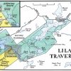
Quetico 2013 – Falls Chain 9/2/2013 – 9/9/2013
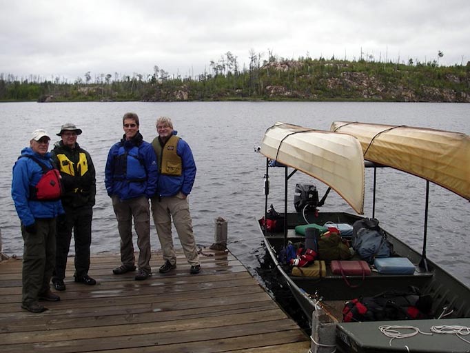
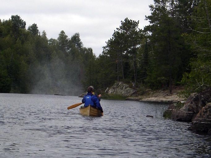
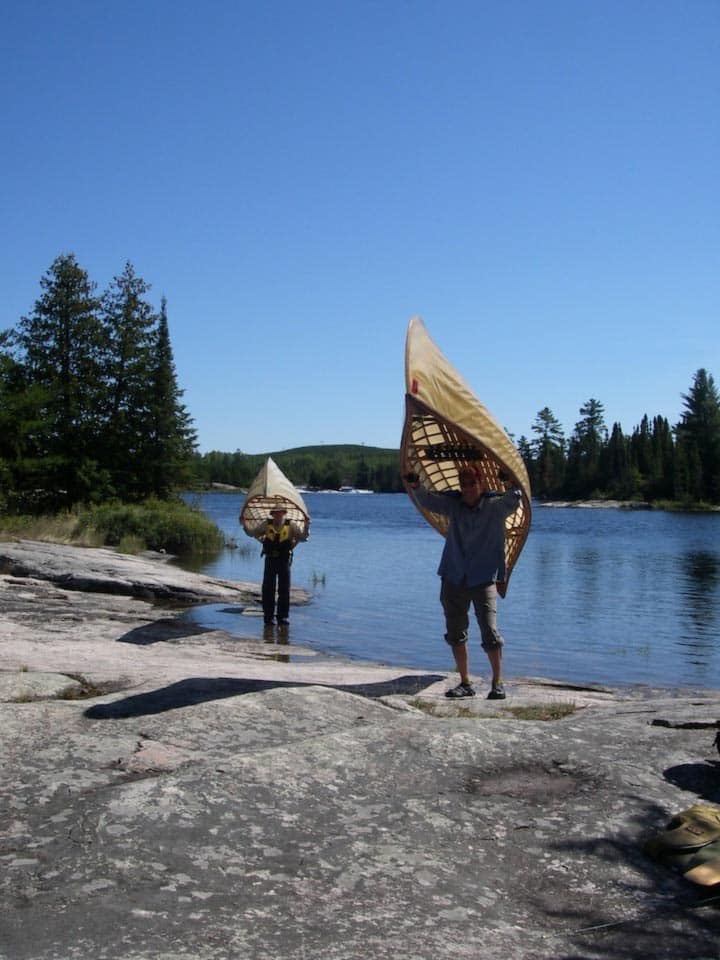
The following is a trip log of four experienced BWCA travelers. Bob, Mark, Jerry and Greg are all either Urban Boatbuilders Board members or volunteers. They paddled skin on frame canoes built by the teen apprentices at UBB (Urban Boatbuilders). Jerry and Greg’s canoe was about 5 years old and has seen many BWCA trips. Mark and Bob’s canoe was built in 2013. It is UBB’s latest canoe design and weighs only 36#. Nice on the portages!
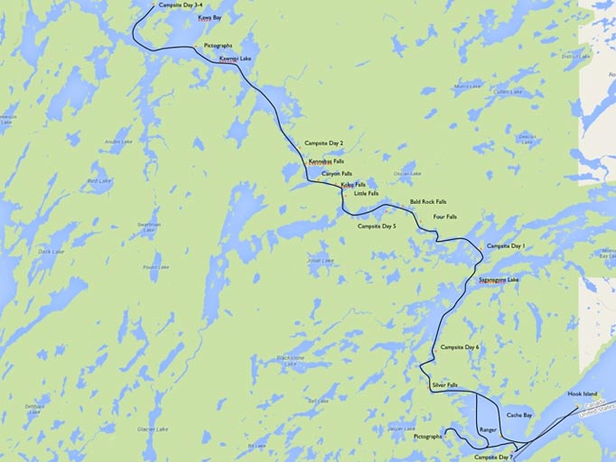
When planning the trip I had trouble deciding how many days it would take. Some trip logs suggest a 4 trip is reasonable up the Kawnipi Lake and back. I have a buddy who goes every year and they make it to Kawnipi Lake in one day. Well, we decided on 7 days. We wanted to take our time. We double portage (there were a lot of portages) and we wanted a layover day on Kawnipi. For reference we normally paddle at about 3 – 3.5 mph but for each day we only averaged 1.5 mph including a lunch break. Considering we took a lot of pictures and spend a lot of time looking for pictographs, I think 7 days was about right.
Day 1:
Bunked overnight at Tuscarora outfitter. The bunk houses were rustic but very clean and comfortable. The staff was outstanding. We arranged for a departure to Saganaga Lake around 8:00. That put us at Hook Island around 10:00 and the Ranger station around 11:00.
We headed north from the ranger station and checked out the island campsite near by. Turned north east and headed to Silver Falls. Undershot the channel leading to the falls but eventually found it. Got to Silver Falls a little before 1:00.
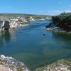
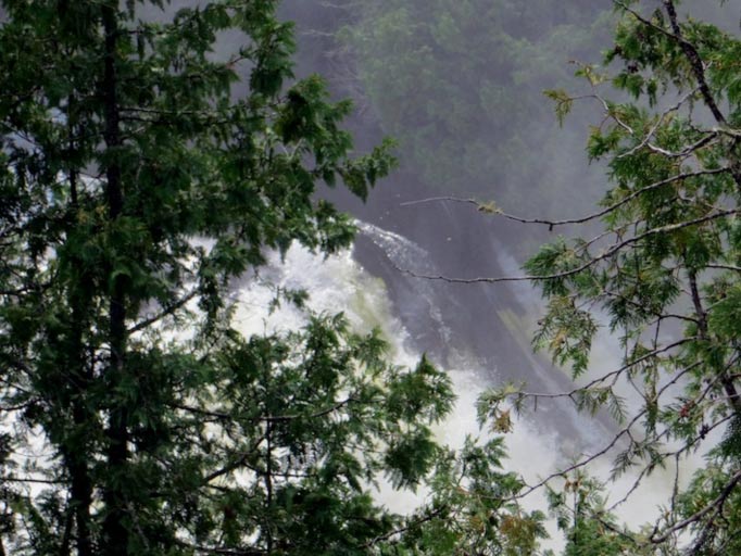
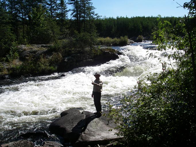
Silver Falls were very impressive! The falls drops about 30 feet and a massive amount of water pours over them. This was our first approach to a significant waterfalls. At first it was a little unnerving. You could see the mist rising from the falls. You could see the drop-off but you didn’t know how strong the current was and the portage landing was only a few feet from the falls.
Between taking tons of pictures and double portaging, we spend a lot of time on this portage. But we were in no rush and wanted to enjoy the moment.
We located the first campsite after the portage and had lunch around 2:00. Lunch was a standard fare of peanut butter and jelly sandwich, cheese, beef stick, dried fruit and a Snicker’s bar.
Soon after, we were on to the next and last portage (deadman’s portage) of the day. As we approached we met two other canoeists looking for the portage. Jerry spotted the landing ahead thru some grassy narrows behind the island.
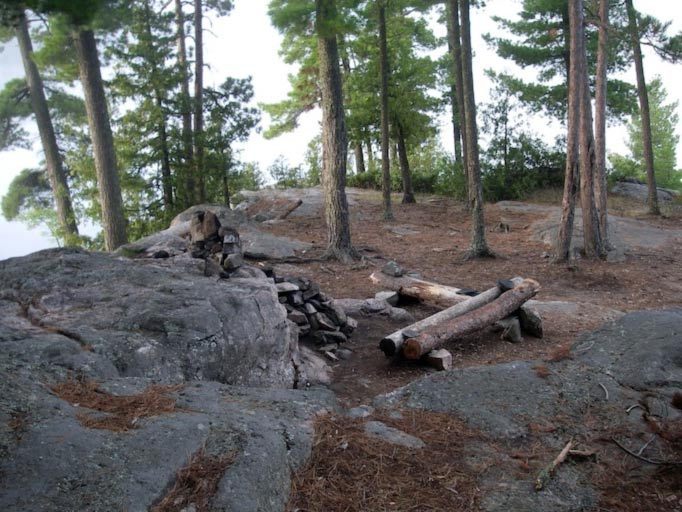
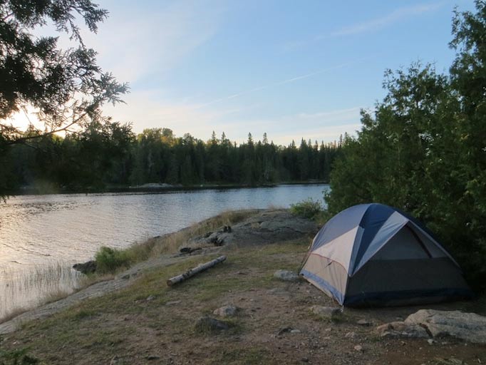
After the portage we looked for a campsite. We missed the turn for the campsite we wanted but found one that was not marked on the map. It was a good site and since it was around 6:00 we decided to stay and set up camp. Mark and Jerry hung their hammocks and Greg and I setup the tent.
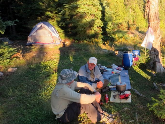
Fired up the stoves for dinner. Greg drew water for the platypus gravity filter (excellent filter) and gathered fire wood for later. As we fell asleep, we could hear a pack of wolves howling in the distance.
Day 2:
Our goal for day 2 was to complete the Falls Chain and find a campsite on Kawnipi Lake.
The next morning were got up around 7:00, which was our usual time for the trip. Made breakfast, etc. and were on the water around 9:30. Through out the trip we tried to speed up our morning activities but to no avail. Some days we might be on the water at 9:15 but it just seemed to take up that long to eat breakfast and break camp.
We paddled west out of Saganagons Lake toward Four Falls. This was another set if beautiful and impressive water falls. The falls drop was only about 20 feed but the falls were very wide with a massive amount of water flowing over them. We took lots of pictures and video.
Bald Rock falls were next. This was a very short portage. We ate lunch on the campsite on the west side of the falls.
After lunch, on to Little Falls, Koko Falls, Canyon Falls and Kennebas Falls. All different and beautiful in their own way. For me, the portage around Canyon Falls was the most challenging. It was not the longest but the footing was the most treacherous. In the middle of the portage you descend into a river bottom with huge boulders. The footing is very tricky. Luckily I was only carrying a pack and not a canoe. Kennebas Falls was interesting. Someone’s canoe was lodged in the trees in the middle of the falls.
Now we were in Kawnipi Lake. We planned to paddle all the way to McKenzie Bay but it was getting late, we were tired and had a moderate head wind. We stopped instead at the first campsite.
Day 3:
Our goal for day three was to find a campsite on McKenzie and to find the pictographs at the mouth of Kawa Bay.
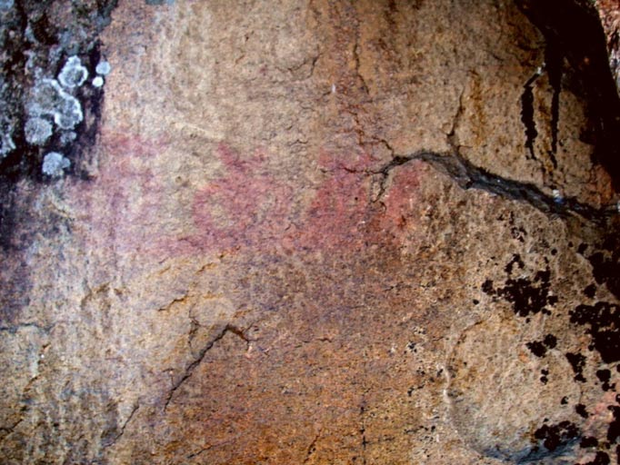
We were on the water at our usual 9:30 and paddled to Kawa Bay to look for pictographs. Mark and I searched the eastern mouth while Jerry and Greg searched the western mouth. There were reported to be pictographs on both sides of the bay. Mark and I found the ones on the eastern side. They were quite faded but identifiable.
We joined Jerry and Greg to look for the pictographs on the western side. We couldn’t find them. Pressing on, we reached McKenzie Bay a little later. We checked out the first campsite but chose one on the island just a little further into the bay. This was the most beautiful and spacious campsite we had ever seen. It was over an acre in size, covered in beautiful pines. The floor was covered in pine needles. It had 3 or 4 different levels and a huge stone fireplace. A perfect spot to base camp.
That afternoon we tried our luck at fishing. Mark and I headlined in one direction and Jerry and Greg in another. It was a big lake and we didn’t know where to fish. Mark soon caught a keeper bass and Jerry caught a northern. Fish for dinner.
Day 4:
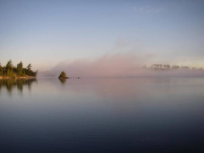
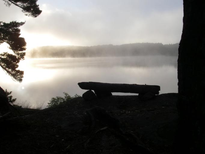
I got up at sunrise. It was not really that early since sunrise was around 7:00. There was a beautiful mist over the lake.
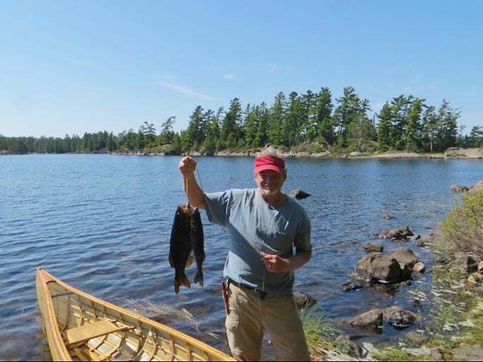
We had no plans for today. Just clean up a bit, fish and hang out. Had a leisurely breakfast of pancakes. Went out fishing around 11:00. Mark and I headed off around the back side of the island, while Jerry and Greg ventured out further up McKenzie bay. We didn’t have much luck but soon ran into Jerry and Greg who found a honey hole. Every time they made a pass they caught something. Greg caught a huge Bass (5# or more). Mark and I fished the same spot with Mark having great success. He pulled out about 7 nice walleyes in the 18”-19” range. We caught too many fish for dinner so several walleyes and the bass went back.
After filleting the walleyes, we observed what appeared to be a pecking order for fish remains: seagulls arrive promptly, were soon evicted by turkey vultures, who in turn fleed from large and in charge bald eagles.
A swim and walleye with “Cajun Shore Lunch” for dinner.
Day 5:
We debated about staying another day or heading back toward Cache Bay. We chose to head back and stay somewhere on the Falls Chain.
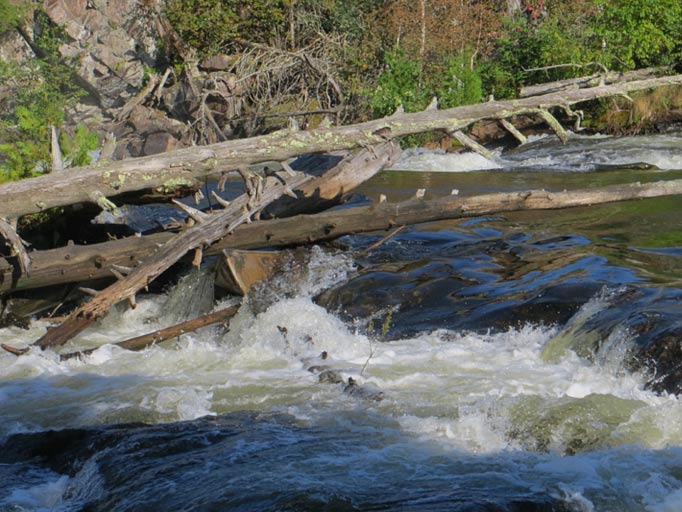
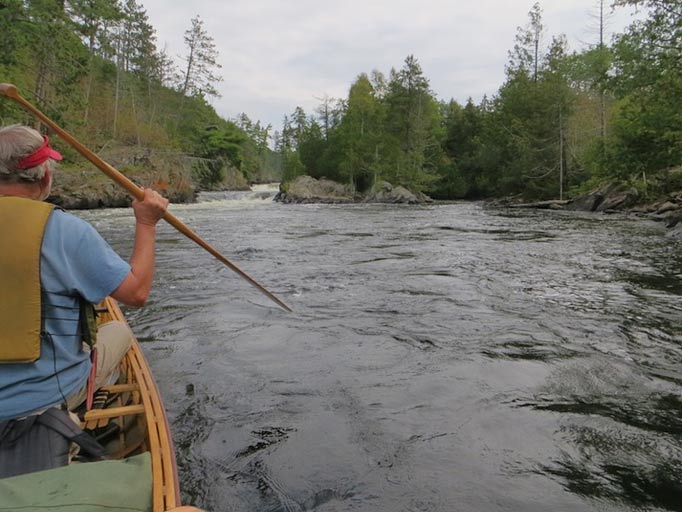
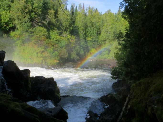
I think we got started at 9:15. On the way back we searched again for the pictographs on the western side of Kawa Bay. No luck again. We stopped by the pictographs on the eastern side of Kawa Bay to test our memories and show them to Jerry and Greg. We did the Falls in reverse, upstream order (Kennebas Falls, Canyon Falls, Koko Falls, Little Falls). We reminded ourselves that most fatal accidents occur going upstream: after portaging around falls, paddlers put-in too casually and get swept backwards over falls.
Notice the turbulence in the water as Greg and Jerry approach the landing of Canyon Falls.
It was sunny and by mid-day it got up to near 80. We stopped a little early at a campsite before Bald Rock Falls. We were hot, sweaty and tired but a swim reenergized us.
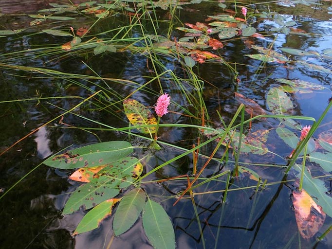
It was a nice campsite but not as luxurious as our last one. The landing was trimmed with a pretty pink flower, water smart weed.
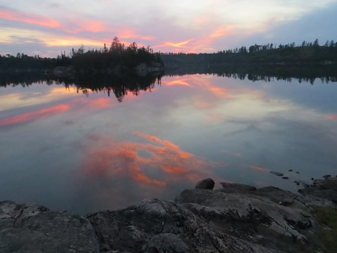
We had a beautiful sunset!
Day 6:
Our plan for today was to paddle to a campsite just before Silver Falls. It was another beautiful day. Not quite as warm as yesterday which was good.
Bald Rock Falls followed by Four Falls. We didn’t take as many pictures this time but we couldn’t resist taking some. Three portages today and we found a campsite early just before Silver Falls. We set up camp and fished a couple of hours with no luck.
Day 7:
Our goal for today was to find the pictographs in Cache Bay and locate a campsite near Hook Island for our tow out.
It was a short paddle to Silver Falls. Hmmm, the portage seemed easier the second time. I guess that is good. If asked, we would probably rate most of the portages 7 out of 10. They weren’t too long, or too steep, or wet. They were very rocky, so you had to be careful where you stepped. Luckily it was not raining because the big rock faces could have been very slippery.
Headed out for our long paddle across Cache Bay. It was a nice day but we had a 12MPH (guessing) head wind. That made a pretty good chop on the bay and the paddling a lot more work. We headed directly south to the bay with the pictographs.
On the way we noticed a 5-6 campsites that we not marked on our McKenzie map. We got to the location in the bay where the pictographs were marked on the map. We searched high and low and could not find them. Bummer. There was a make shift campsite near so we stopped for lunch. During lunch, we pulled out the pages from the book “Magic on the Rocks”. In the book the pictographs were marked in a close but different location. With renewed energy we paddled back to the other location and found the pictographs a clear as day.
Fifty photographs later, we headed back into Cache Bay to find our final campsite. Being afraid that bad weather that might prevent us for catching our return tow, we headed back towards Hook Island. We stayed on the campsite just outside Cache Bay but still in the Quetico.
Day 8:
We had fantastic weather our whole trip but on our final day it was overcast. Pulling out all the stops, we decided to try to empty the breakfast food barrel. Pancakes, eggs, and prosciutto for breakfast. We ate until we were full and then ate some more.
With no rush to get to Hook Island we broke camp around 10:00. The overcast sky turned into a light mist followed by a light rain. We had time to kill so we explored some BWCA campsites getting us to Hook Island by 11:00. Our tow arrived soon and before we knew it we were back at our truck, heading home.
Summary:
Hands down this was the best wilderness trip I have been on. The lakes were crystal clear and beautifully studded with islands, cool rock formations, water falls, pictographs, great campsites and wonderful weather. This trip had it all.